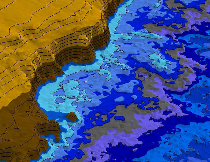
AI MSS delivers high-precision geophysical data processing and interpretation for offshore developers, supporting effective geohazard, geological, and UXO risk assessments. Our reports provide a holistic evaluation of site characteristics and conditions, enabling clients to make safe, informed decisions for site exploration and development.
AI MSS, combines industry-leading software, geophysical science, and marine regulatory insight to deliver fully tailored reporting outputs. Whether identifying surface or subsurface risks or supporting permitting, our data-driven approach provides comprehensive insights to guide safe and informed offshore development, through:
Our geophysical reporting services are modular, precise, and built to support safe, compliant offshore development at every stage.
Gain a comprehensive understanding of seafloor and subsurface conditions. We identify geohazards, characterise geology, and support safe infrastructure planning through the analysis of MBES, SSS, SBP, MAG data.
We combine historical research, legacy geophysical data, and newly acquired datasets to assess UXO risks. Our UXO reports support ALARP decision-making and effectively guide targeted ground-truth inspections.
With deep multidiscipline expertise, AI MSS offers unmatched clarity in geophysical reporting. Our team applies scientific rigour and regulatory understanding to help clients turn complex data into actionable project insight which seek to minimise risk at ALARP levels while accelerating permitting approval and phase consensus.